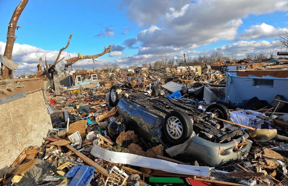
Death and disaster struck a handful of US-Midwest states over weekend

Do Scores of Tornadoes Slamming Midwest Redefine
“Tornado Alley?”
Tornado watches had been declared for swaths of Illinois, Indiana, Iowa, Michigan, Missouri, Ohio, and Wisconsin on Sunday. On Sunday evening, the National Weather Service said there had been 77 tornadoes reported, mostly in Illinois, although the agency warned that some of those numbers could represent multiple accounts of the same storm.
While its the Great Plains states of Kansas, Nebraska, the Dakotas, and part of Texas that are collectively known as Tornado Alley for their frequent storms, the weekend was a reminder that Illinois, Indiana, Iowa, Michigan, Missouri, Ohio, and Wisconsin are also tornado-prone.
“It turns out that the [phrase Tornado Alley] isn’t correct,” says the Weather Channel’s website. The site said that Florida actually gets more tornadoes per square mile than any other U.S. state.
Other states that also get as many or more tornadoes per square mile than the classic “Tornado Alley” states include Indiana, Illinois, Iowa, and Louisiana.
“If we looked at states that get more than a handful of tornadoes just about every year, then the entire area east of the Rocky Mountains—excluding New England, New Jersey, and Delaware—could be called the “tornado strike zone,” the Weather Channel’s site added. (Related: “Is There a Tornado/Climate Change Connection?”)
Part of the reason why Tornado Alley has achieved so much attention is because it occupies a unique geographic position where warm humid air from the Gulf of Mexico, hot dry air from Arizona and New Mexico, and cool dry air from Canada meet, explained Christopher Karstens, a research scientist with National Oceanic and Atmospheric Administration’s (NOAA) National Severe Storms Laboratory (NSSL) in Norman, Oklahoma.
“In the springtime, those air masses tend to work together to create environments that we saw [on May 20 and May 31],” he told National Geographic earlier this year, referring to two tornado-heavy days.
“Sometimes they collide in Oklahoma, sometimes in Texas, and sometimes in Kansas.”
Although tornadoes tend to occur most frequently in May and June, they can happen during any month of the year, if atmospheric conditions are right.
While the United States has perhaps the best historical records for tornadoes, twisters also occur elsewhere, including in Italy, India, and South America. (Related: “Lessons From Joplin’s Recovery“)
Another area with similar conditions to Tornado Alley is Bangladesh, said Chris Weiss, an atmospheric scientist at Texas Tech University.
“They have a lot of violent tornadoes—some would argue even stronger [storms] and tornadoes—over there,” Weiss said. “But a lot go unreported because they don’t have nearly the observation network over there that we have over here.”
How Tornadoes Form
While tornadoes can differ in size, strength, and location, they all share certain characteristics. They are spawned from a type of rotating storm called a supercell thunderstorm.
And they are all driven by atmospheric instability and by a phenomenon known as wind shear.
This happens when “wind near the ground blows in one direction, but aloft it blows in another direction. This creates shear in the airflow,” Karstens explained. “If you produce an updraft within that flow, the updraft will acquire the properties of the air, and the atmosphere begins to spin and rotate.”
While scientists understand some of the basic setup conditions necessary for tornado formation, there are still many fundamental questions about tornadoes that remain unanswered.
Tim Samaras, a tornado chaser and National Geographic grantee who was killed by a twister on May 31, 2013 in El Reno, Oklahoma, said earlier in the year that we have a lot to learn about how tornadoes form.
“We still don’t know why some thunderstorms create tornadoes while others don’t,” he said.
Tornado Forecasting
Tornadoes are much more difficult to forecast than hurricanes. For example, the National Hurricane Center was able to predict the path of last year’s Hurricane Sandy with startling accuracy a full five days before it made landfall.
In contrast, even though residents of Moore, Oklahoma, had advanced warning that a potentially dangerous storm was moving in last May, they had only 16 minutes after the first warning on May 20 before the tornado touched down.
Part of the difficulty, Karstens said, is that tornadoes are much smaller than hurricanes. “It’s really a matter of scale,” he explained. “With the hurricane being so large, we’re able to populate our models with lots of points to resolve it and we can come up with much more accurate multiday forecasts.”
Secondly, while current computer models can predict when a supercell storm is likely to form, not all supercell storms give rise to tornadoes.
“That’s one of the questions we’re struggling with as scientists: which storms will be the ones to go on producing tornadoes and which ones won’t?” Karstens said.
Karstens is involved in an NSSL project that aims to predict a tornado’s path shortly after it forms, called Warn-on-Forecast.
He’s optimistic that tornado forecasting will improve as computers and tornado modeling software become more powerful, and as more environmental data such as temperature and dew point measurements are gathered close to tornado-spawning storms by instruments and tornado researchers.
“We’ve got a long way to go,” he said, “but I think we’re making steady progress.”
Jane J. Lee contributed reporting to this article.

